 |
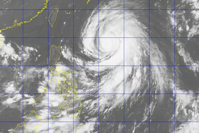
| around 7 a.m., Helen’s eye was located 1,080 kilometers east of Aparri, Cagayan or 1,085 km East of Calayan, Cagayan, based on all available data. PAGASA/Released | CT Philstar |
MANILA, Philippines (UPDATED) — The Philippine Atmospheric, Geophysical and Astronomical Services Administration (PAGASA) on Sunday said Typhoon “Helen” (International name: Megi) has maintained its strength and direction towards the Batanes-Taiwan area.
Due to this, Batanes and Babuyan Group of Islands were placed under tropical cyclone signal warning no. 1.
At 10 a.m., Helen’s eye was located 1,025 km East of Calayan, Cagayan.
Helen continues to move in a west-northwest direction, according to PAGASA. It was forecast to move in that route at 22 kilometers per hour.
PAGASA said Helen is packing maximum sustained winds of up to 140 kph near the center and gustiness of up to 175 kph. It is expected to bring moderate to heavy rains within the 800 km diameter of the typhoon.
Helen entered the Philippine area of responsibility (PAR) on Saturday afternoon.
Forecast positions
- 24 hour (Monday morning): 510 km east of Basco, Batanes
- 48 hour (Tuesday morning): 255 km north of Basco, Batanes
- 72 hour (Wednesday morning): 580 km northwest of Basco, Batanes (outside PAR)
- 96 hour (Thursday morning): 905 km west northwest of Basco, Batanes (outside PAR)

No comments:
Post a Comment