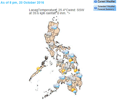
 |
Satellite Image courtesy of PAG-ASA | Harold Ayao
|
PAG-ASA however, has not lifted its advisory for Sea travel as its still too risky over the northern and eastern seaboards of Northern Luzon and western seaboard of Cental Luzon.
Tropical storm signal is now down to Signal #1 with expected winds of (30-60 kph
Expected in 36 hours) Areas under this Tropical Cyclone warning signal are as follows: Ilocos Norte, Ilocos Sur, La Union and Abra
| Satellite Image courtesy of PAG-ASA |
| Following are its current data: | |
| Location of Eye/Center: (as of 4:00 p.m.) | 240 km West Northwest of Laoag City, Ilocos Norte |
|---|---|
| Coordinates: | 19.2°N, 118.6°E |
| Strength: | Maximum sustained winds of up to 130 kph near the center and gustiness of up to 160 kph |
| Movement: | Forecast to move Northwest at 22 kph |
| Forecast Positions/Outlook: |
|
| TROPICAL CYCLONE WARNING SIGNAL | ||||
| TCWS | Luzon | Visayas | Mindanao | Impact of the wind |
| 1 (30-60 kph Expected in 36 hours) | Ilocos Norte, Ilocos Sur, La Union and Abra | •Very light or no damage to low risk structures, •Light damage to medium to high risk structures •Slight damage to some houses of very light materials or makeshift structures in exposed communities. Some banana plants are tilted, a few downed and leaves are generally damaged •Twigs of small trees may be broken. •Rice crops, however, may suffer significant damage when it is in its flowering stage. | ||
| Wave Height: (Open Sea) 1.25-4.0 meters | ||||
| ||||

No comments:
Post a Comment